Hudson River Paddling Conditions Near Garrison, NY
Nearby locations
Fort Montgomery Cold Spring
All 49 locations
Conditions at
Now
—
What to expect speeds assume a 3 mph base pace
Heading north
— expected speed
Heading south
— expected speed
River Current
NOAA ACT3726_1 West Point
Flood — north, upriver
Ebb — south, downriver
Tide
NOAA 8518949 Peekskill
Unless you plan on landing on a beach or poking into a shallow creek, tide is likely not very important to you.
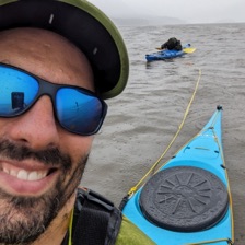
Hi, I’m Dan! I built this site because I paddle on the Hudson with my family (that’s my 10-year-old son I’m towing through a rainstorm on our way from Cold Spring to Beacon). The site is free. If you find it helpful and want to support it, you can buy me a coffee.
Buy me a coffee
Sun & Moon
computed for 41.38°N 73.95°W
Important note
Tides and currents are predictions, not observations. Wind, waves, runoff, storm surge and other factors can affect actual conditions. Weather is sourced from the National Weather Service. Use your own judgment and paddle at your own risk.
Current from NOAA station ACT3726_1 off West Point, about a mile upriver. NOAA publishes a flood heading there but no ebb, so both are the river’s own axis at Garrison — which is not Cold Spring’s: World’s End turns the river more than forty degrees between the two. Tide from NOAA station 8518949 at Peekskill, about six miles downriver. Both are predictions, baked into this page and good through 31 Dec 2028; values between NOAA’s published points are interpolated. Weather and alerts come live from the National Weather Service grid covering Garrison. Water temperature has no nearby sensor — it is estimated between NOAA The Battery, downriver, and NOAA Turkey Point, up. Sun and moon are computed rather than fetched, and agree with the US Naval Observatory to within a couple of minutes.
NOAA currents ↗ NOAA tides ↗
Site and photos by Dan Blumberg.
Feedback? Something you wish this site had? Want to paddle? Email me: hello at hudsonconditions dot com
© 2026 Modern Product Minds LLC